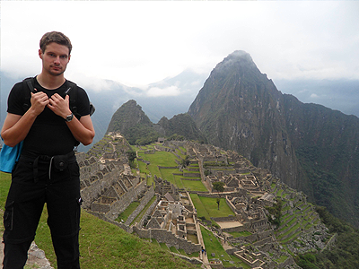
Right away Romain feels a change in the weather - Destination South America. What land borders Ecuador and Colombia to the north, Brazil to the east, Bolivia to the southeast, Chile to the south, and the Pacific Ocean to the west? This is where our journey begins in the land of Peru.

When we look back in history in this area, the The Mesoamerican civilization, known as the Inca Empire, was located in the Andes mountains. The Incans gave their empire the name, 'Land of the Four Quarters' , or the Tahuantinsuyu Empire. It stretched north to south along the high mountainous Andean range from Colombia to Chile, and reached west to east from the dry coastal desert called Atacama to the steamy Amazonian rain forest. Stretching 2,500 miles, the Inca Empire had a short life of only about a hundred years. Most of what is known of their culture comes from early Spanish accounts and archeological finds. When the Spanish conquered the Inca in 1532, they were a small ethnic group based in Cusco, ruling more than 12 million from 100 different cultures, and speaking at least 20 languages. The Inca used gifts as well as spears to demonstrate power to potential subjects.
Northwest of Cusco, on the crest of the mountain is Machu Picchu, which has an altitude of 11,800 ft. Most archaeologists believe that Machu Picchu was built as an estate for the Inca emperor (1438–1472). Often referred to as "The Lost City of the Incas", it is perhaps the most familiar icon of the Inca World. It is one of the most important archaeological sites in South America, one of the most visited tourist attractions in all of Latin America . As we continue on southwesterly , ahead of us is Choquequirao, which means "cradle of gold" in Quechua, although this is probably not its original Inca name. It is another "lost city of the Incas" located high on a ridge spur ,above the raging glacier-fed Apurimac River on the Salkantay Mountain Range in the Province La Convención in the Cusco. The site is reached by a two-day hike from outside Cusco, ( known as the Choquequirao Trek ). In one of the earlier blogs we showed how you could find North using RGM's Model # 254 North Pointer GMT in the Northern Hemisphere - its a little different in the Southern - heres how:
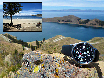
To find north while you are in the southern hemisphere: Hold the watch parralel to the ground. Point the 12 o'clock position so it is pointed at the sun. The point half-way between the hour hand and the 12 o'clock position will be north. Note: During daylight savings time you may want to use the 1 o'clock position to get a more accurate bearing. Crossing the border into Bolivia we continue South to Copacabana. It is the main Bolivian town on the shore of Lake Titicaca , from where boats leave for Isla del Sol , the sacred Inca island. With winter upon us here in Mount Joy , Penna - it's nice to hear the words , " the island of the sun", Isla del Sol is an island in the southern part of Lake Titicaca. Geographically, the terrain is harsh. It is a rocky, hilly island. There are no motor vehicles or paved roads on the island. No better place for RGM's North Pointer GMT to be in this rugged South American adventure. Continue with RGM's North Pointer and Romain as we continue our Journey in the Southern hemisphere of South America , when we make our way North to Columbia.


